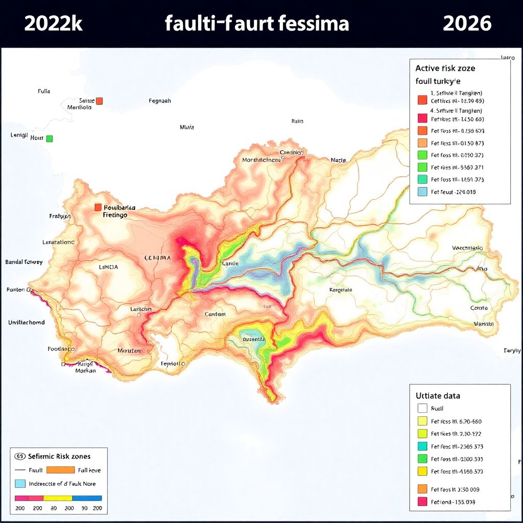
Türkiye Active Fault Line Map 2026: Updated Data, Higher Numbers, New Risk Picture
After a 13-year break, Türkiye’s official active fault map has been completely revised – and the new version significantly reshapes the country’s earthquake risk profile. The General Directorate of Mineral Research and Exploration (MTA) has announced the “Türkiye Diri Fay Haritası-2026” (Türkiye Active Fault Map 2026), prepared on the basis of extensive fieldwork and academic studies.
According to MTA Director General Vedat Yanık, the number of identified active faults in Türkiye has risen sharply: from 485 in the previous 2013 edition to 700 in the new 2026 version. This increase does not mean that new faults suddenly appeared, but that existing structures have been mapped and classified more precisely thanks to improved data, technology and field investigations.
This updated map, developed in cooperation with AFAD and supported by MTA’s long-term geological and seismological studies, is now considered one of the most critical tools for earthquake risk analysis in the country. It allows decision-makers to see much more clearly which provinces, districts and settlement areas are located directly on or near active fault segments.
What changed in the 2026 Türkiye Active Fault Map?
The most striking change is numerical: the catalog of active faults has expanded from 485 to 700 segments. These are faults that show evidence of activity in the recent geological past and are considered capable of generating earthquakes in the future.
Compared to the 2013 edition, the new map incorporates:
– New field measurements and trench studies carried out over the last 13 years
– Reassessment of previously known fault lines with higher-resolution data
– Integration of academic research and university-based projects
– Updated segmentation and classification of faults according to current scientific criteria
MTA emphasizes that this is not merely a cartographic update, but a fundamental refresh of the national seismic database. The 2026 map will serve as a basis for revising risk scenarios, building codes, land-use planning and large-scale infrastructure projects.
Official presentation and strategic importance
The “Türkiye Diri Fay Haritası-2026” was presented to the public during Scientific Activities Week and the 91st anniversary of MTA. In his speech at the launch event, MTA Director General Vedat Yanık underlined how meaningful it was for the institution to mark its founding anniversary by releasing such a vital national data infrastructure product.
Yanık recalled that MTA, established in 1935 under the vision of Gazi Mustafa Kemal Atatürk, has steadily increased its strategic importance. He referred to Atatürk’s words at the founding of the institution, when he assigned MTA the mission of investigating the country’s geological resources and expressed hopes for “happy surprises” to be discovered beneath the ground. Yanık noted that this sentence has, for 91 years, been both a mission statement and a source of motivation for continuous exploration.
A century of discoveries: from Batman to Eskişehir
In describing MTA’s historical role, Yanık highlighted milestones ranging from Türkiye’s first oil discovery in Batman to the strategic rare earth element fields in Eskişehir-Beylikova. He also mentioned major copper deposits in Elazığ-Maden, Sinop-Boyabat and Kahramanmaraş, as well as hundreds of industrial raw material resources that form the backbone of domestic industry.
Against the backdrop of changing global dynamics, Yanık stressed that the demand for minerals and energy resources is growing, and thus the strategic value of earth sciences is rising accordingly. According to him, MTA continues to stand at the forefront of this process, combining modern technologies with local expertise and environmentally sensitive exploration methods.
Why an updated fault map matters more than ever
The new active fault map is not just an internal product for geologists. It has direct implications for:
– National security: Large earthquakes can destabilize critical infrastructure, energy lines, logistics corridors and defense facilities. Knowing the exact position and behavior of faults is key to protecting these assets.
– Sustainable development: New settlements, industrial zones and transportation projects must be planned with up-to-date seismic data to minimize future losses.
– Disaster risk reduction: Accurate mapping allows AFAD and other institutions to refine earthquake scenarios, update emergency plans and allocate resources more effectively.
Yanık emphasized that Türkiye, located on the Alpine-Himalayan orogenic belt, lives with active tectonics as a daily reality. For such a country, having a current and scientifically robust picture of active structures is a strategic necessity, not a luxury.
13 years of data: from 2013 to 2026
Since the publication of the 2013 map, MTA has carried out a sustained program of detailed fieldwork and academic collaboration. Over these 13 years, researchers have collected a large volume of new data, including:
– Geological mapping at higher scales
– Paleoseismological trench studies to identify past earthquakes
– Geophysical measurements and GPS-based deformation analyses
– Remote sensing and satellite imagery interpretations
This accumulated knowledge formed the backbone of the 2026 update project, which was included in the investment program in 2022 and brought to completion after intensive work. The end result is a more granular and realistic representation of Türkiye’s active tectonic network.
What does the increase from 485 to 700 active faults mean?
The rise in the number of identified faults does not automatically mean that earthquake danger has suddenly grown. Instead, it reflects:
– Better recognition of previously unmapped or poorly defined fault segments
– Splitting of long, generalized fault lines into more realistic sub-segments
– Reclassification of some structures as “active” based on new evidence
From a risk-management standpoint, however, this higher-resolution picture is crucial. Authorities can now pinpoint with greater precision which localities lie directly on active faults, which are near major rupture zones and which are relatively more distant. This, in turn, informs microzonation studies, local building regulations and prioritization of retrofitting efforts.
Provinces and districts: who is in the risk group?
Although the map is a nationwide product, its practical value emerges at the regional and local level. Provinces located along major fault systems – such as the North Anatolian Fault, East Anatolian Fault and other active zones – are once again confirmed as high-risk areas.
Within these provinces, the updated segmentation can reveal:
– Districts that sit directly atop active fault traces
– Settlement areas that may be affected by surface ruptures in a large earthquake
– Valleys, basins and alluvial plains prone to ground amplification and liquefaction
Local administrations, urban planners and engineers are expected to use the new map in combination with detailed local ground studies to design safer urban transformation and infrastructure projects.
How will AFAD and MTA use the 2026 map?
The new active fault map forms a central layer in Türkiye’s broader disaster-risk information infrastructure. In practice, it will:
– Feed into national and regional earthquake scenario models
– Support the updating of hazard maps and design spectra used in structural engineering
– Guide the selection of locations for critical facilities such as hospitals, schools, data centers, dams and energy plants
– Contribute to contingency planning, evacuation routes and emergency logistics planning
By combining this geological data with population density, building stock information and infrastructure maps, institutions can create more realistic loss estimates and prioritize investment in risk reduction.
Implications for construction and urban planning
For architects, engineers and developers, the 2026 fault map is a reference that should not be ignored. While building codes already require seismic design throughout the country, being located directly on or near an active fault line can demand additional precautions, such as:
– Avoiding construction directly on mapped surface rupture zones
– Applying stricter design criteria in areas with high expected ground motion
– Incorporating ground-improvement techniques where soil conditions are poor
– Planning wider corridors and open spaces that can serve as evacuation and assembly areas
Urban renewal projects in older, densely built neighborhoods will especially need to take the new map into account in order to reduce vulnerability before the next major earthquake occurs.
Public awareness and individual preparedness
An updated fault map also has educational value. When clearly explained and visualized, it helps citizens understand that earthquake risk is not abstract but tied to specific geological structures beneath their feet. This awareness can encourage:
– More conscious decisions about where to live and work
– Greater attention to building quality and structural safety reports
– Higher participation in earthquake drills and preparedness programs
– Increased demand for insurance and retrofitting of existing buildings
Experts underline that even in areas not sitting directly on an active fault, strong shaking can still occur due to the propagation of seismic waves. Therefore, the map should be seen as a guide to understanding risk variations, not as a simple “safe/unsafe” classification.
Looking ahead: continuous updates instead of one-off projects
The 2026 Türkiye Active Fault Map is a milestone, but not the final word. Tectonic research, instrumentation and analytical methods are advancing quickly. In the coming years, MTA and partner institutions are expected to:
– Expand the monitoring network with more seismic and GPS stations
– Carry out additional paleoseismological studies to refine fault histories
– Integrate three-dimensional models of the crust and fault geometry
– Develop digital platforms that allow dynamic visualization and updates of fault data
The aim is to transform the fault map from a static printed document into a living, continuously updated national database that supports real-time risk management.
A new era in Türkiye’s earthquake risk analysis
With the publication of the 2026 edition, Türkiye’s active fault inventory has entered a new era. The increase from 485 to 700 mapped active faults, the integration of 13 years of scientific data and the emphasis on national security and sustainable development all underscore how central earth sciences have become for the country’s future.
In a region where major earthquakes are a recurring reality, the “Türkiye Diri Fay Haritası-2026” is more than a technical map. It is a roadmap for safer planning, smarter investments and more resilient communities – provided that its findings are translated into concrete policies, regulations and everyday practices.